Thanks to Board Member, Bill Sellin for this thorough analysis. And thanks to Brian Cox, Greg Klein, and Bill for tireless follow-through on this issue.
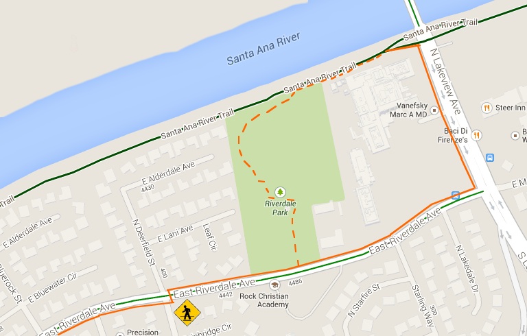
 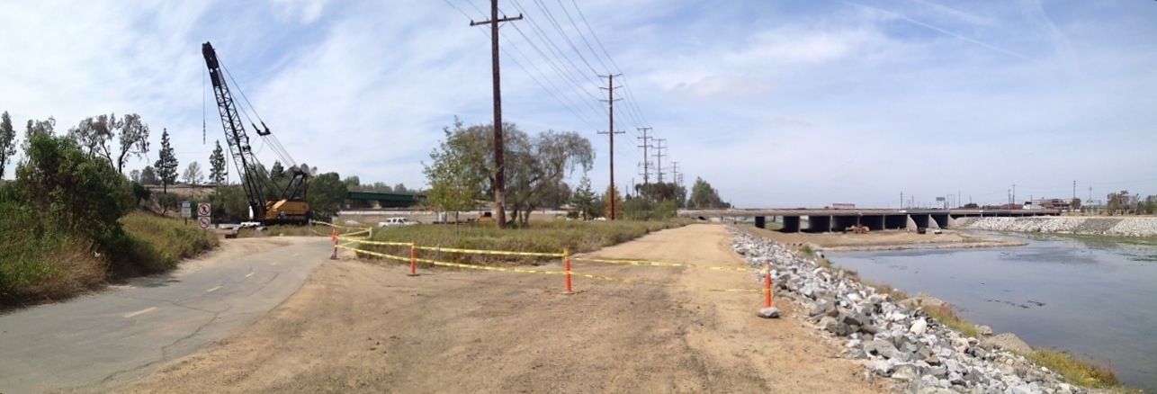 The Santa Ana River Trail (SART) has a 1.3 mile detour due to widening of the 91 Freeway Bridge over the River. OC Parks has jurisdiction over the SART and it is a precious recreational facility. It is not actually an optimal transportation corridor, as it has a 10 MPH speed limit and is closed after dusk, so it was surprising that a full mile of perfectly usable parkway facility has been fenced off unnecessarily- The Orange County Bicycle Coalition met with OCTA, CalTrans, OC Parks and Anaheim Traffic staff on May 5th to explore options to improve the detour, and some improvements have been made, but more issues are outstanding. Already closed in March 2014 it will be shut down until October 2015! Red Outline shows actual construction & staging zone – closed to all public access: 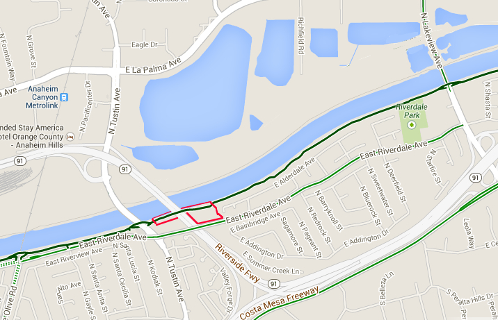
Downstream (West) on SART from North Lakeview Street to North Tustin Avenue in Anaheim. 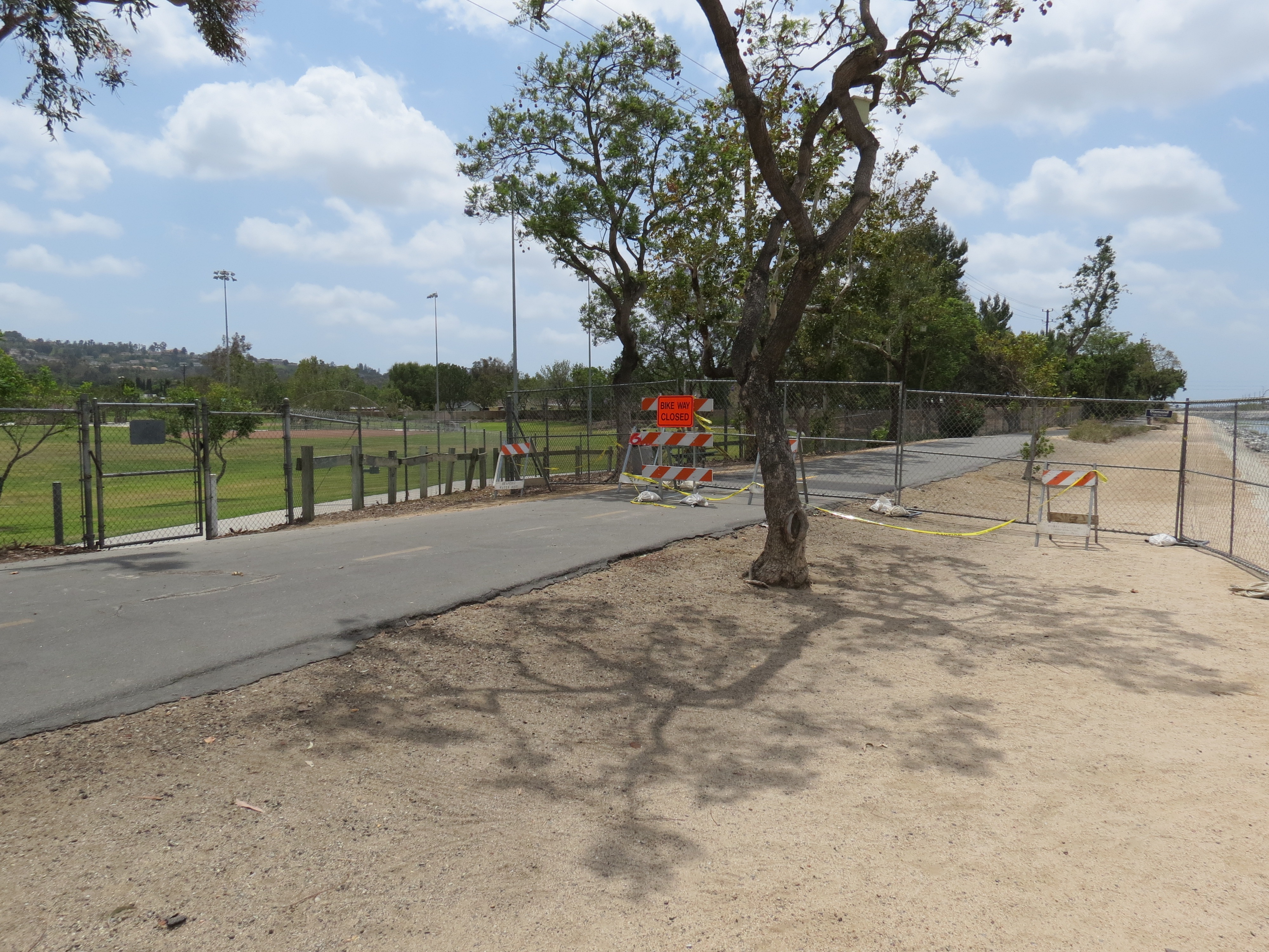
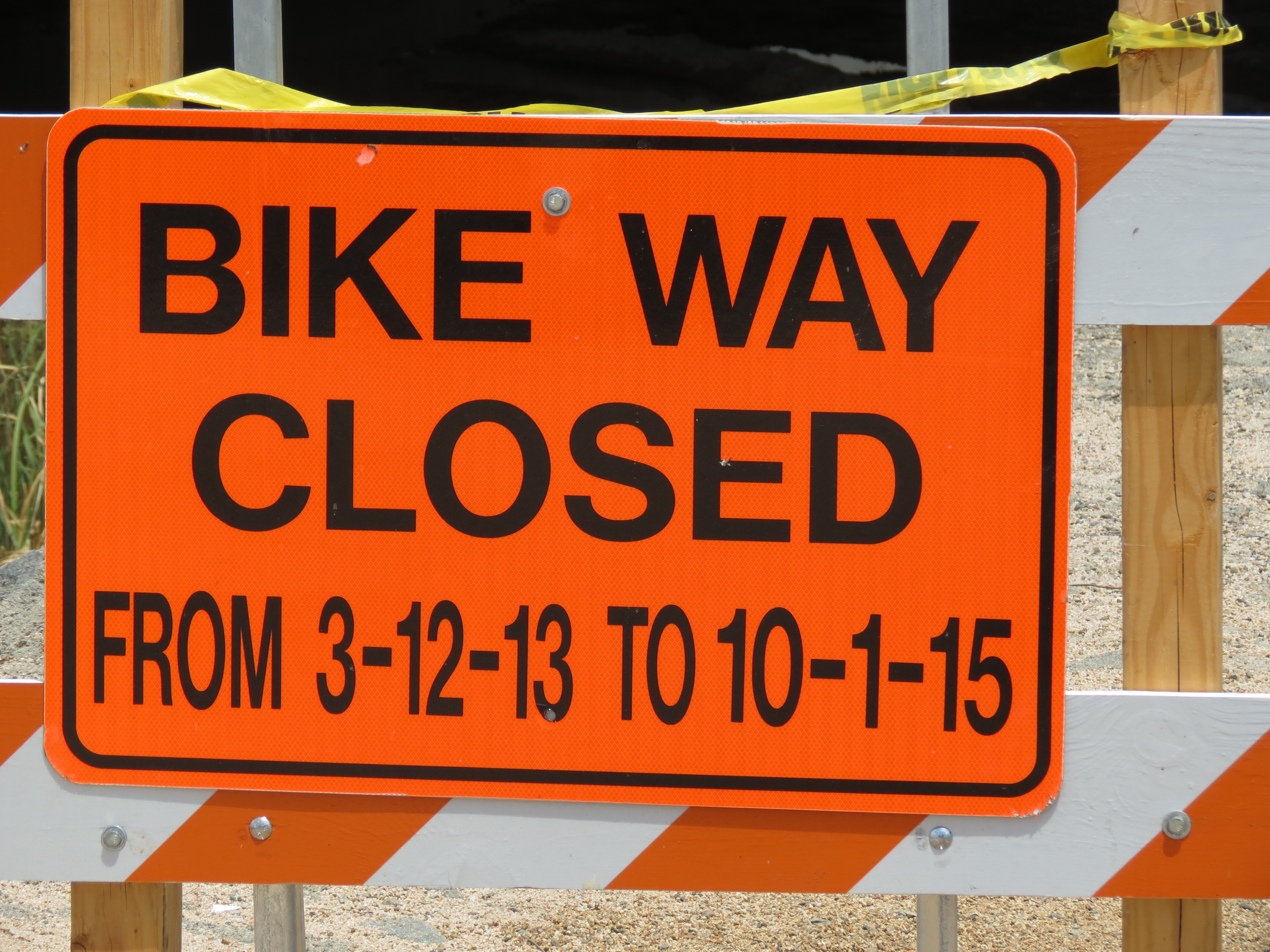
Even though the construction zone is only just east of the 91 Freeway bridge over the Santa Ana River, a detour In stead of just saying “BIKE WAY CLOSED” A sign saying:
would let folks know they can enjoy the trail to the construction zone, but not get to Tustin Ave or beyond, and will have no outlet… And pedestrians could be directed to go through Riverdale Park  The public could still enjoy the portion of the trail parkway between N Lakeview Dr & the closed construction A Sign for SB at the SART connector saying
could help alert motorists and direct bicyclists heading to SART to ride down stream before they enter the connector . SART is a Nationally recognized & designated hiking & equestrian trail, so closure also directs those other users onto
Redirected SART users are only one block out of their way on East Riverdale Ave. East Riverdale has 4 travel lanes and a center turn lane at the east end, a posted speed limit of 45 MPH, and some of the narrowest Bike Lanes in Orange County. These sub-standard Bike Lanes could be left as ridable shoulders
& have Sharrows painted in the right travel lane if the speed limit was reduced to 35 MPH during this detour period. If you are a pedestrian, you will wish to have crossed to the south side of the street at N Deerfield St, as there is no sidewalk on the north side after N Torrens St, 2 blocks away. There is no sign suggesting to do so at Deerfield so if pedestrians continue they will end up walking on the road way in the bike lane, illegally facing with traffic, or will cross with out a cross walk at N Torrens Street. Farther west the road is reduced to 2 lanes, and goes over a bridge above the 91 freeway. At Tustin Avenue the posted detour directed users to cross Tustin to the NW corner (no cross walk – so again pedestrians were not considered for direction to cross Tustin then Riverdale). South Bound Tustin has a free right turn onto West Bound Riverdale, so extreme caution is prudent as motorists will not have a signal to stop them before turning through the cross walk. The original detour turned north on the side walk against traffic (on the wrong side) of Tustin Avenue to connect with the SART connector to resume traveling west bound. Fortunately, at the urging of OCBC Board members and SART users, CalTrans promptly removed the fence blocking the underpass below Tustin, and OC Parks reopened the gate to SART so now SART users can turn right on N Tustin and resume the SART from the east side of NB Tustin. NB Tustin has a side walk but no bike lane. Upstream (East) on SART from North Tustin Avenue to North Lakeview Street in Anaheim 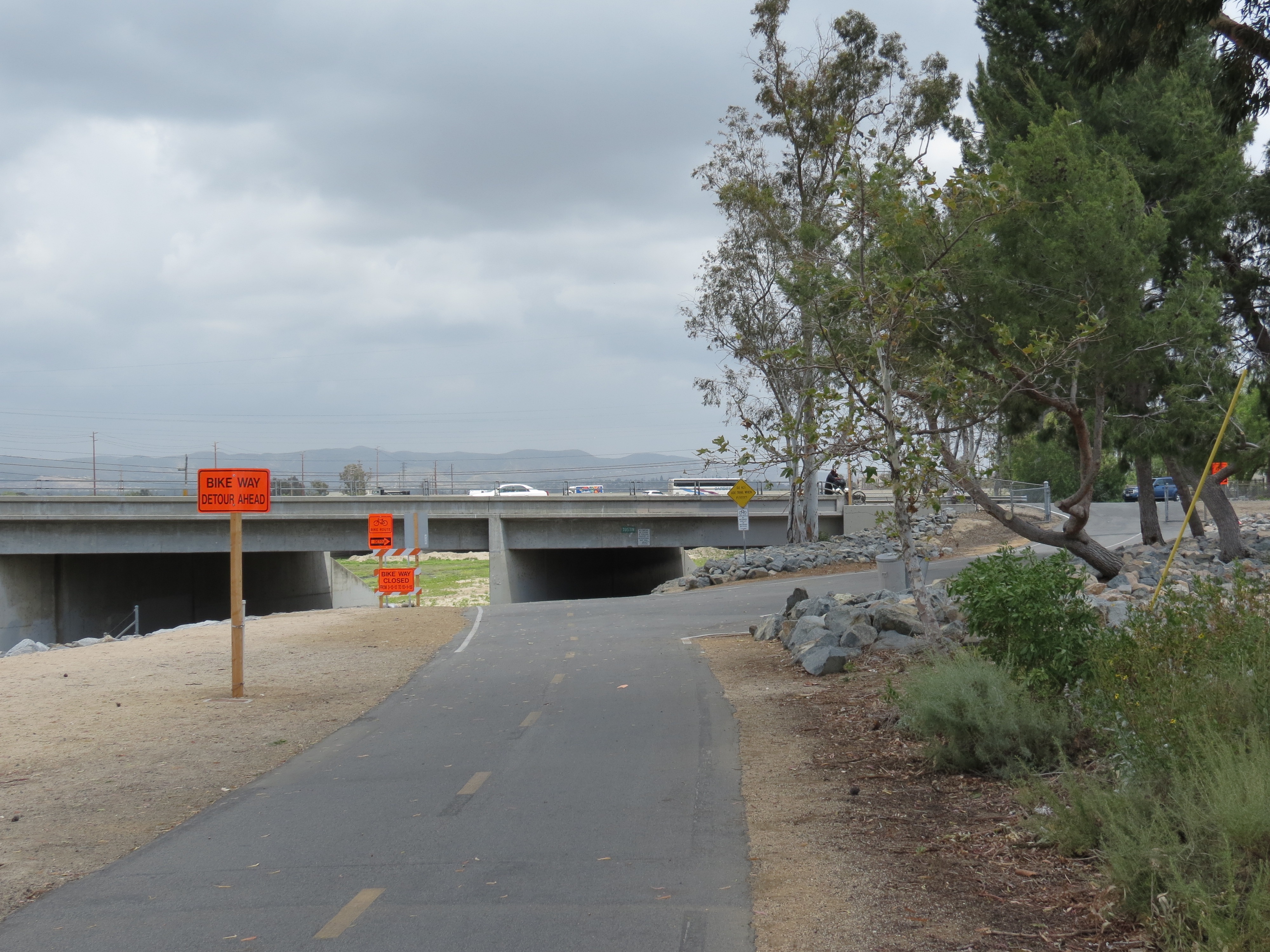 The Detour begins just west of N Tustin Avenue. A Sign on SB Tustin saying:
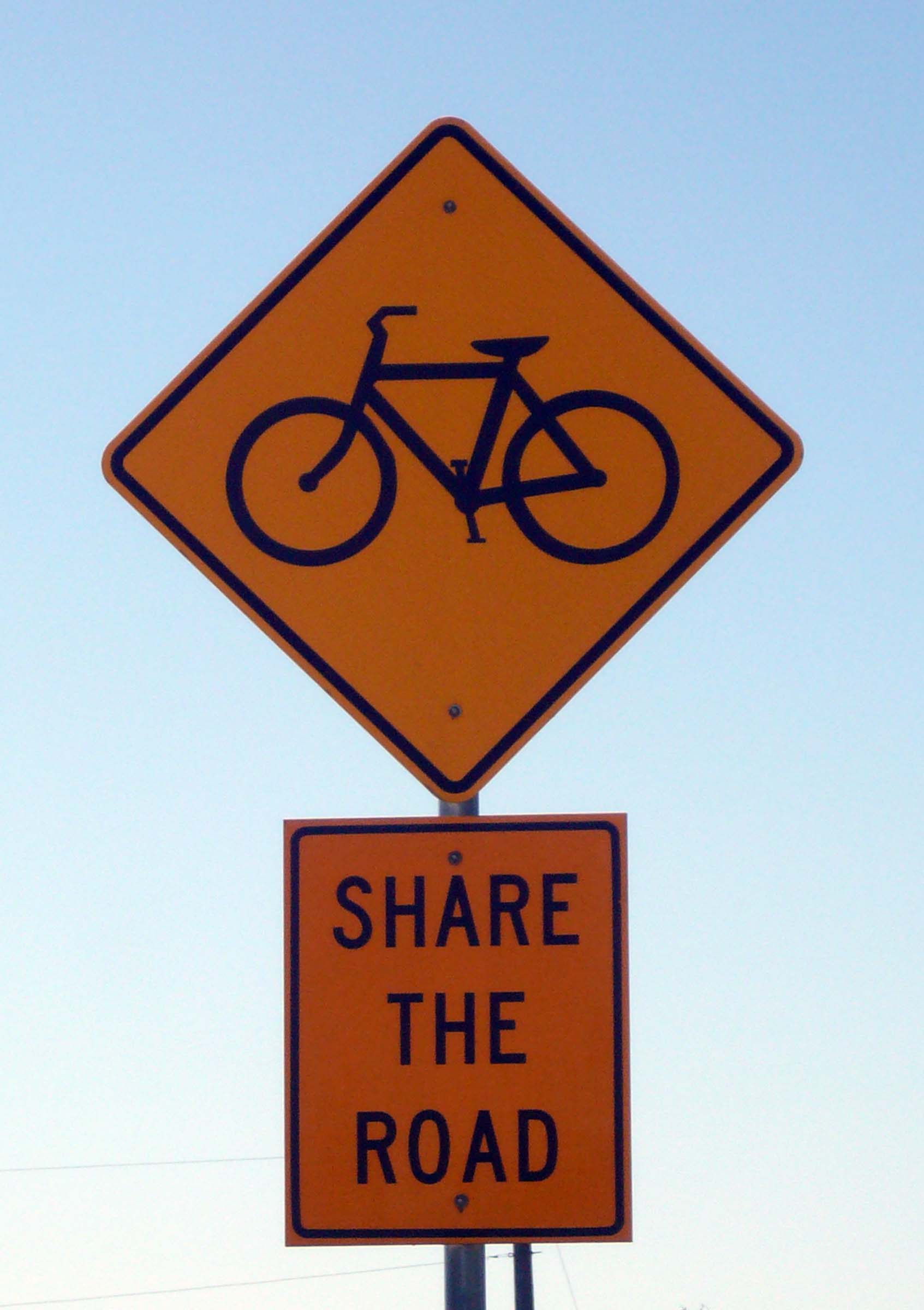
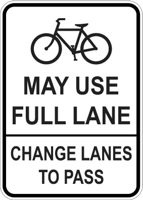
could help alert motorists and direct bicyclists heading to SART to ride up stream, before they enter the connector from Tustin Ave. South Bound Tustin has no bike lane and has a free right turn onto West Bound Riverdale, so extreme caution is prudent as motorists will not have a traffic light to stop them before turning across the cross walk. Bicycle drivers will merge with traffic and take the left turn lane pocket at Riverdale. Unfortunately Anaheim has chosen to not cycle the signal, but only give a left when the sensor loop detects a waiting vehicle, and it would not pick up a wheel as of May 5th 2014. That forces bicyclists to illegally turn against the red light or wait until joined by a motor vehicle. If warned, Bicyclist could be directed to do a “box turn”, proceeding across Riverdale in the cross walk, then proceeding east on Riverdale. The Bike Lane on 2 lane Riverdale runs over a bridge above the 91 freeway, then expands to 4 travel lanes with a center turn lane. It has a posted speed limit of 45 MPH, and very narrow sub-standard bike lanes. (see above) There is only a side walk on the south side (east bound) side of East Riverdale but it continues to cross walks at N Lakeview. To short cut through Riverdale Park, Pedestrians should use the cross walk at Deerfield to get on the side walk on the north side of the street. At Lakeview the detour turns left onto north bound Lakeview, again at the mercy of Anaheim to cycle the signal, not only give a left when the sensor loop detects a waiting vehicle. That forces bicyclists to illegally turn against the red light or wait until joined by a motor vehicle. If warned, Bicyclist could do a box turn, proceeding across N Lakeview Ave in the cross walk, then proceeding north on N Lakeview Ave. back to the SART. Pedestrians have a cross walks to get to the east side of N Lakeview & easily back to the SART. The detour concludes at the connector to SART. Unfortunately the curb bulbs out where a 90° turn onto the connector from the north bound Bike Lane on Lakeview is a bit risky… going up the drive way onto the side walk is a more prudent approach that edge riders and side walk riders will prefer. CalTrans is looking into putting an asphalt ramp up the curb to help edge riding get off the street safely, however that could facilitate encouraging wrong way riders illegally flowing south bound onto the edge of the north bound road. Remedies Proposed May 5th; 4 members of the Orange County Bicycle Coalition Board and a concerned local resident met with OCTA, CalTrans, OC Parks and Anaheim representatives on May 5th and discussed several improvements. 1: Remove the blocking fence west of N Tustin Avenue, to allow use of the trail under the road to the east side – for connection to N Tustin Ave Northbound, and to allow west bound SART traffic to turn onto N Tustin Ave & connect to west bound SART – open existing gate. (Done in 48 hours) (CalTrans / OC Parks) 2: Change the DETOUR direction to turn right on N Tustin to get to the SART on the correct side of the street, and end detour at connector from NB Tustin Ave. (CalTrans) 3: Remove the blocking fence just west of N Lakeview Avenue, to allow pedestrian / equestrian access to Riverdale Park and the rest of the SART between the detour and the full closure at the construction zone. (Moved back 200 feet in 48 hours, but should be at construction site & not block entire trail parkway access for local use) (CalTrans / OC Parks) 4: Change the SHARE THE ROAD signs to BIKE MAY USE FULL LANE signs. (CalTrans) 5: Re stripe the Bike Lanes on E Riverdale Ave to standard width or more, or black out the Bike Lane symbols to leave them as ridable shoulders, lower the speed limit to 35 MPH and paint sharrows in the right most lanes. (Anaheim) 6: Consider ramping the curb from NB Lakeview to SART connector at east end of the detour.
Lend your support? PLEASE:
Contact the City of Anaheim & ask that – Bring E Riverdale Avenue Bike Route up to State Standards – Eliminate free right turns from N Tustin onto E Riverdale ( North bound to east bound AND south bound to west bound) – Welcome bicycles in Riverdale Park & any other city park that prohibits them! – Next time, contact the OC Bicycle Coalition for help & input BEFORE impacting bicycle access. Contact OC Parks and ask that … – Public access be preserved in the mile of beautiful parkway between Lakeview, Riverdale Park and the closed work zone near the 91 freeway. Allow the public to enjoy walking, cycling, birding, dog walking, horse riding etc. on this stretch even if closed to through traffic past the closure. – Provide information on the detour, duration and public access (local recreation – not through traffic) – Next time, contact the OC Bicycle Coalition for input BEFORE impacting bicycle access. Contact CalTrans and ask that … – Pedestrian trail users be guided through the detour
WB E Riverdale @ N Deerfield – NE corner
SB N Deerfield @ E Riverdale – SE corner
EB E Riverdale @ N Deerfield – SE corner – Allow public access to SART between Riverdale Park & the Closed Construction zone
Relocate the fence from Riverdale Park 1 mile west to the edge of the construction closure zone near the 91 freeway – Promote access to Riverdale Park from SART
Signs at Entrance to Riverdale Park walkway @ E Riverdale Ave:
facing Riverdale Park @ E Riverdale Avenue
facing EB sidewalk on N side of E Riverdale @ park walkway Sign on SART facing the gate from Riverdale Park
– change the DETOUR sign a NE corner of N Tustin directing right turn NB on N Tustin from West Bound E Riverdale Ave instead of WB across Tustin – with no cross walk – Move the east construction zone fence from Riverdale Park access all the way west to the actual construction zone site. – Secure BOTH of the construction zone fences east of Tustin Avenue and east of the construction zone:
Lock them: Only lightly wired together, public or contractor are already snipping wires to enter 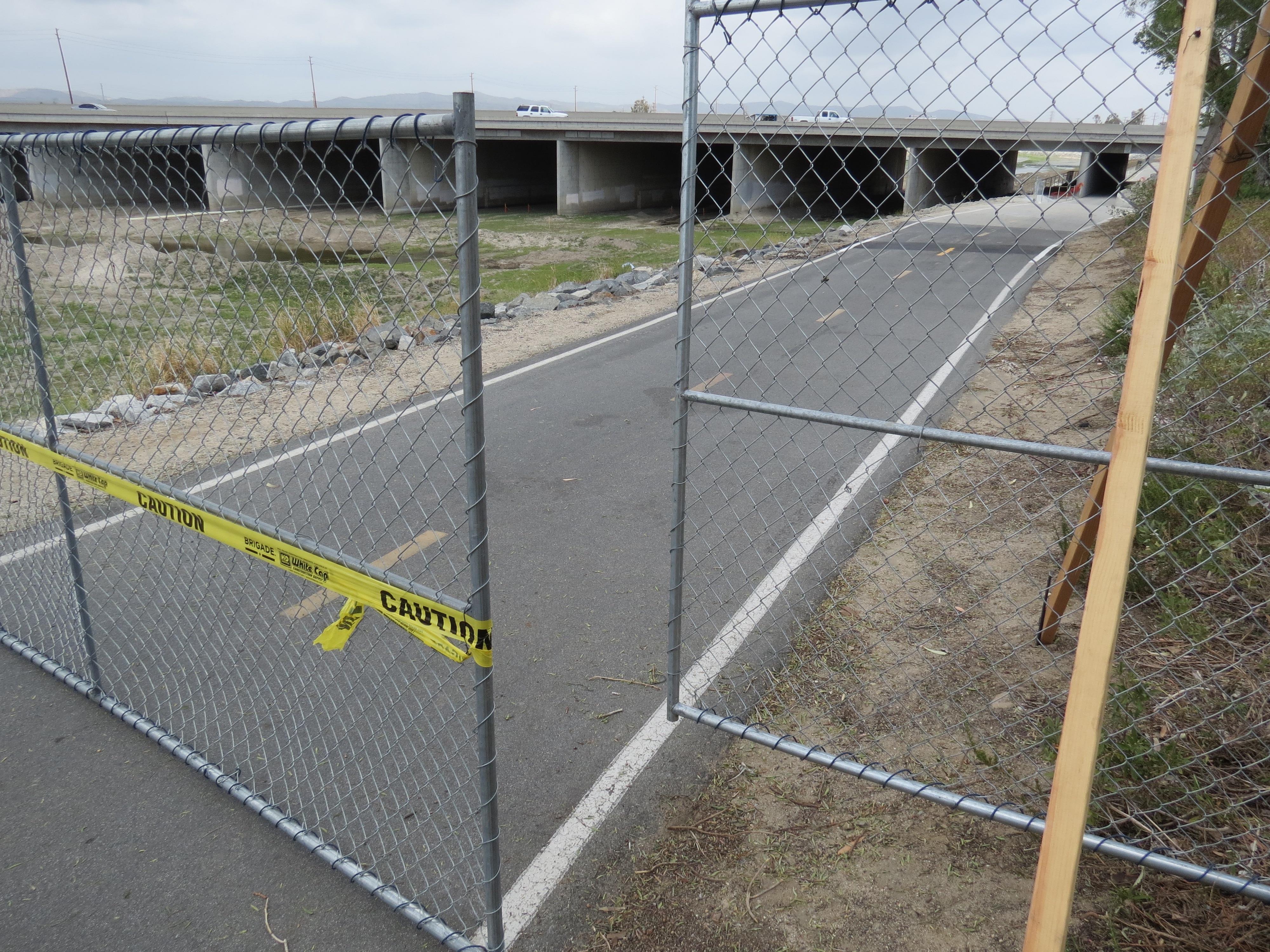 Place reflective barricades in front of or inside the chain link – in case some one is riding SART in the dark; 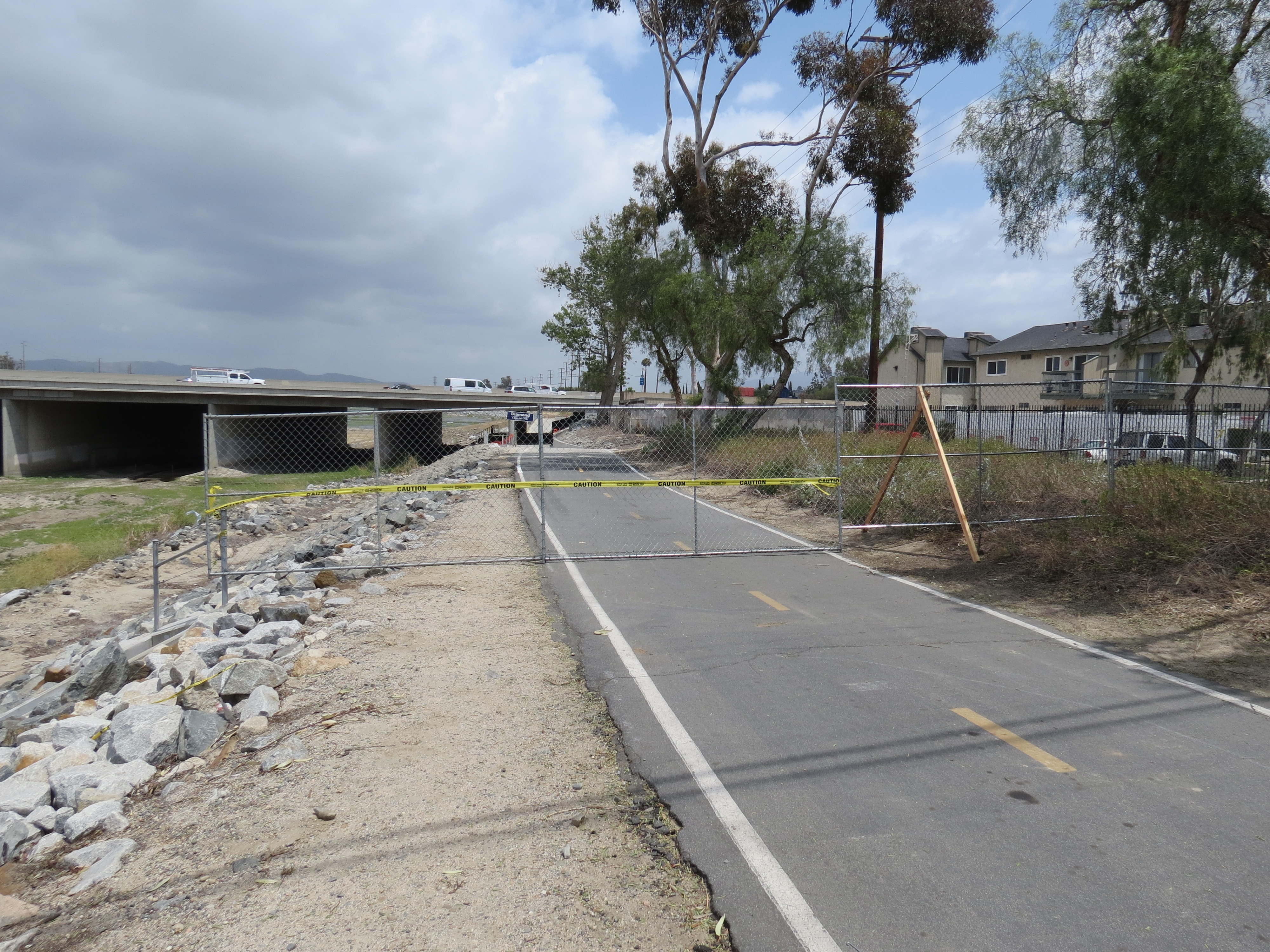 – THANK THEM for promptly removing the fence west of Tustin Avenue [removed 5/7/14] and reopening the access on east side of N. Tustin Ave 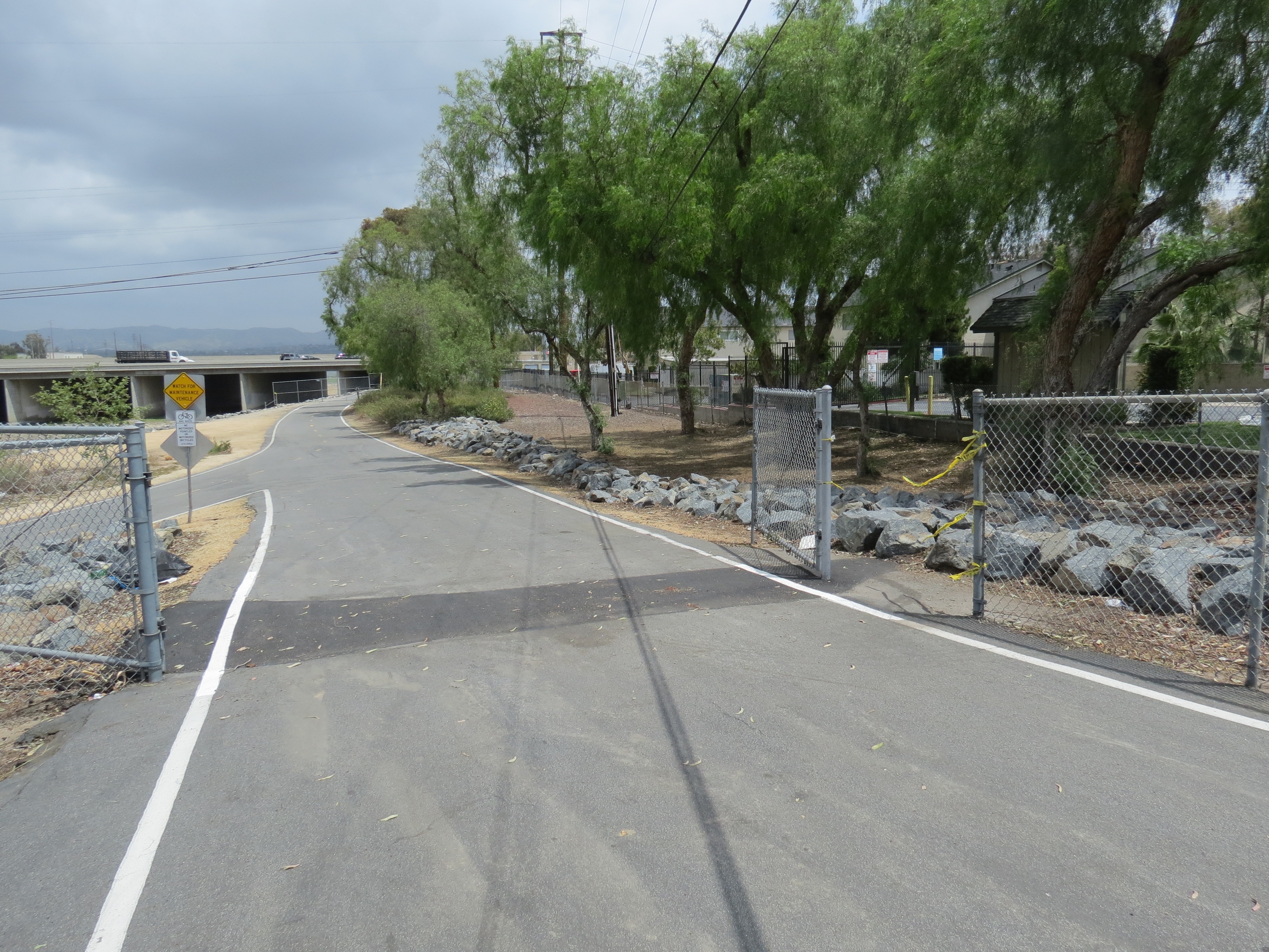 – THANK THEM for moving the fence west of Lakeview Avenue back to the Riverdale Park entrance [moved 5/7/14] – Next time, contact the OC Bicycle Coalition for input BEFORE creating a problem. |
|||||||||||||||
| Updated May 8, 2014 – Please Contact Bill with any updates or corrections! Post observations on our FaceBook page … |